Cochituate Rail Trail Slideshow (November 2006)
The Cochituate Rail Trail project began planning in 1997, with the formation of Bicycle and Pedestrian Advisory Committees in Framingham and Natick. The last train left at the end of 2005, and both towns are now negotiating with CSX (Natick), the Massachusetts Turnpike Authority and MBTA (Framingham). Many related resources will be on or near this major trail project.
Topics: History; Discussion and Design; Trail-Clearing, Construction and Maintenance; Mainline views; Downtown Natick - Commuter Rail and Bicycle Parking; Snake Brook Trail; Natick Mall and spur line; Cochituate State Park; Pegan Cove Park; Saxonville; NSTAR Powerline 1-81; more to come?
Except as otherwise noted, this presentation and its contents are by A. Richard Miller and are copyrighted 2006 by Miller Microcomputer Services.

At first page Next page 1-48 (of 67 found)
050511NatickRRStaPan PART 1 - Downtown Natick, Commuter Rail and Bicycle Parking.
The Natick Center Commuter Rail Station, with downtown Natick just beyond the Walnut Street pedestrian bridge and with the start of the CRT at extreme right. The 2001 mural celebrates Natick's 350th anniversary with various scenes from its past.
This panorama view is spliced from three photographs. To maximize (Zoom) it, tap your keyboard's

PART 1 - Downtown Natick, Commuter Rail and Bicycle Parking. The Natick Center Commuter Rail Station, with downtown Natick just beyond the Walnut Street pedestrian bridge and with the start of the CRT at extreme right. The 2001 mural celebrates Natick's 350th anniversary with various scenes from its past. This panorama view is spliced from three photographs. To maximize (Zoom) it, tap your keyboard's "Z" key several times.

041206WalnutStBridge On a cold December day in 2004, bicycles show the demand for better commuter bicycle parking to come.

On a cold December day in 2004, bicycles show the demand for better commuter bicycle parking to come.

040719WalnutStBridge And in July, the demand is even greater.

And in July, the demand is even greater.

040424NatickRRSta Down on the Natick Commuter Rail platform, looking west .

Down on the Natick Commuter Rail platform, looking west .

060429NatickStationPlatformAndBottomOfCRT Below the Walnut Street bridge and the Main Street bridge beyond, the start of the Cochituate Rail Trail curves off to the right.

Below the Walnut Street bridge and the Main Street bridge beyond, the start of the Cochituate Rail Trail curves off to the right.

crt01 PART 2 - Mainline Views.
Dick Miller just north of Route 9, in 2001.
(Photo courtesy of Jill Miller.)

PART 2 - Mainline Views. Dick Miller just north of Route 9, in 2001. (Photo courtesy of Jill Miller.)

011027CRT-FisherStNatick-North The CRT at Fisher Street in North Natick (2001).

The CRT at Fisher Street in North Natick (2001).

060416Rte9CRTBridge1 One major example of pre-existing railroad infrastructure is the CRT bridge over Route 9.

One major example of pre-existing railroad infrastructure is the CRT bridge over Route 9.

060416Rte9CRTBridge2 A close-up, including Natick's Springvale Pumping Station.

A close-up, including Natick's Springvale Pumping Station.

060416Rte9CRTBridge3 The Route 9 bridge is strong enough to hold a locomotive, but it will need paint and a redesigned deck.

The Route 9 bridge is strong enough to hold a locomotive, but it will need paint and a redesigned deck.

000924Rte9RRBridge You wouldn't want to bike over that! Walking over Route 9 traffic isn't much nicer, because of those open gaps between the railroad cross-ties.

You wouldn't want to bike over that! Walking over Route 9 traffic isn't much nicer, because of those open gaps between the railroad cross-ties.

P5150033 Atop the boat tunnel, with Carling Pond beyond.

Atop the boat tunnel, with Carling Pond beyond.

P5150047

P5150041

P5150049 A view of Lake Cochituate's Middle Pond, from the CRT.

A view of Lake Cochituate's Middle Pond, from the CRT.

P5100012 On the CRT by Middle Pond.

On the CRT by Middle Pond.

P5100010 The old Wonderbread switch -- which will become the start of the side path to Natick Mall. Rusty rails in 2005.

The old Wonderbread switch -- which will become the start of the side path to Natick Mall. Rusty rails in 2005.

000924WonderbreadSwitch Looking north at the same switch (in 2000, when freight traffic kept the rails shiny).

Looking north at the same switch (in 2000, when freight traffic kept the rails shiny).

010316Rte30andSpeen1 Urban blight; looking east on Route 30 to the Speen Street traffic lights. The CRT crosses just beyond.
Urban blight; looking east on Route 30 to the Speen Street traffic lights. The CRT crosses just beyond.

010316Rte30Speen2 At the same intersection. That green is the day-use area of Cochituate State Park, beyond the CRT in the distance. It's a welcome oasis here.

At the same intersection. That green is the day-use area of Cochituate State Park, beyond the CRT in the distance. It's a welcome oasis here.

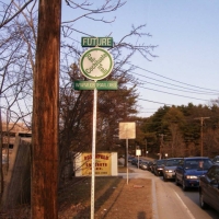
040326FutureCRTSign The CRT promises an alternative to traffic for some of these rush-hour drivers on Route 30.

The CRT promises an alternative to traffic for some of these rush-hour drivers on Route 30.

040426Rte30CementPlant More urban blight at Route 30, on the Framingham-Natick town line. This cement plant encroaches on the CRT right-of-way; it was moved partway back a few years before.

More urban blight at Route 30, on the Framingham-Natick town line. This cement plant encroaches on the CRT right-of-way; it was moved partway back a few years before.

040605CRT2 The same crossing, but the view from the CRT right-of-way south over Route 30 looks a lot nicer!

The same crossing, but the view from the CRT right-of-way south over Route 30 looks a lot nicer!

000924CRTatTJX A northbound bicyclist on the CRT, crossing the Speen Street entrance to TJX.

A northbound bicyclist on the CRT, crossing the Speen Street entrance to TJX.

040605CRT3 North of Route 30, the rails and ties were removed in 1991. Volunteers have cleared trees and brush, so the trail looks like this.

North of Route 30, the rails and ties were removed in 1991. Volunteers have cleared trees and brush, so the trail looks like this.

040605JillOnCRTBridge A little east of the CRT and south of Old Connecticut Path, Framingham's Cochituate Brook Reservation includes this lovely bridge at the site of a once-busy mill dam. There's trout in that brook.

A little east of the CRT and south of Old Connecticut Path, Framingham's Cochituate Brook Reservation includes this lovely bridge at the site of a once-busy mill dam. There's trout in that brook.

040605CRT1 At Old Connecticut Path, the waiting trail is gated to keep out vehicles and dumping. Please report any violations.

At Old Connecticut Path, the waiting trail is gated to keep out vehicles and dumping. Please report any violations.

010818NorthEndOfCRT Let's head back from the northeast end of the CRT, at School and Central in Saxonville. The CRT starts at that street sign. The near end of the crosswalk aims right at it; we hope Framingham will line up the far side, as well.

Let's head back from the northeast end of the CRT, at School and Central in Saxonville. The CRT starts at that street sign. The near end of the crosswalk aims right at it; we hope Framingham will line up the far side, as well.

020120CRTSchoolSt In snow, that trail and the mis-aligned crosswalk are more obvious than in the prior photo.

In snow, that trail and the mis-aligned crosswalk are more obvious than in the prior photo.

020120CRTSkiing Trails are a lot of fun in the winter, too!

Trails are a lot of fun in the winter, too!

020120CRTJohnBrennanBales John Brennan is  one of the busiest volunteers who  help create the Cochituate Rail Trail.

John Brennan is one of the busiest volunteers who help create the Cochituate Rail Trail.

010609CSPKayakRentals PART 3 - Cochituate State Park.
Back to some warm-weather fun! Our rail trail connects a LOT, including this popular park on the major recreational lake in eastern Massachusetts Boat rentals, swim area, and much more.

PART 3 - Cochituate State Park. Back to some warm-weather fun! Our rail trail connects a LOT, including this popular park on the major recreational lake in eastern Massachusetts Boat rentals, swim area, and much more.

010901CSPKayaks The view south on Lake Cochituate's Middle Pond. It's the smallest of the three major ponds in this lake chain.
(Photo courtesy of Carey VandenAkker.)

The view south on Lake Cochituate's Middle Pond. It's the smallest of the three major ponds in this lake chain. (Photo courtesy of Carey VandenAkker.)

010609CSPBoatRentals Iif you don't want to paddle a canoe or a kayak, you can row your boat.

Iif you don't want to paddle a canoe or a kayak, you can row your boat.

040426Sailboats1 High-school sailboat racing is also popular on Lake Cochituate.

High-school sailboat racing is also popular on Lake Cochituate.

010905CSPCRTshirt PART 4 - Snake Brook Trail.
CRT activist Jill Miller shows off a CRT-shirt -- and one of Cochituate State Park's

PART 4 - Snake Brook Trail. CRT activist Jill Miller shows off a CRT-shirt -- and one of Cochituate State Park's "Snake Brook Trail" markers.

020226JillonSnkBkTrail Where the CRT is wide and smooth, the Snake Brook Trail is narrow and winding, one of the various types of trails within the greater CRT network.

Where the CRT is wide and smooth, the Snake Brook Trail is narrow and winding, one of the various types of trails within the greater CRT network.

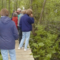
SBTtour010515 A nature walk along the Snake Brook Trail.

A nature walk along the Snake Brook Trail.

P9240007 The Snake Brook Trail begins at Route 27 on the Natick-Wayland town line, with a short boardwalk between the brook and a wetland. The boardwalk was an Eagle Scout project in 2000, with good support from Cochituate State Park.

The Snake Brook Trail begins at Route 27 on the Natick-Wayland town line, with a short boardwalk between the brook and a wetland. The boardwalk was an Eagle Scout project in 2000, with good support from Cochituate State Park.

CRTtiretoss010428 PART 5 - Trail Clearing and Maintenance.
In 2001, a first clean-up of the CRT south of Old Connecticut Path found a lot of tires downhill from a car-repair buiding. Abandoned rail lines become dumps.

PART 5 - Trail Clearing and Maintenance. In 2001, a first clean-up of the CRT south of Old Connecticut Path found a lot of tires downhill from a car-repair buiding. Abandoned rail lines become dumps.

P4280081 A rail trail project brings willing eyes and arms, to keep it clean.

A rail trail project brings willing eyes and arms, to keep it clean.

CRT-clearing010512 While awaiting formal trail development, volunteers opened the trail. They clean and trim it several times each year.

While awaiting formal trail development, volunteers opened the trail. They clean and trim it several times each year.

011020CRT-Rte30b When the volunteers had cleared all the trees from the Framingham length of the trail, they finally opened it up to view from Route 30 (October 2001).

When the volunteers had cleared all the trees from the Framingham length of the trail, they finally opened it up to view from Route 30 (October 2001).
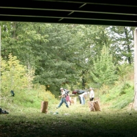
041002CRTCleanUp1 Framed in its MassPike underpass, the CRT gets another grooming.

Framed in its MassPike underpass, the CRT gets another grooming.

041002CRTCleanUp2 Regular brush doesn't need special handling. But we carefully bag and remove invasive plants, such as honeysuckle and Japanese knotweed.

Regular brush doesn't need special handling. But we carefully bag and remove invasive plants, such as honeysuckle and Japanese knotweed.

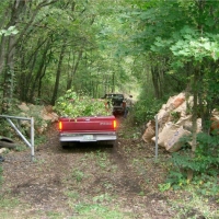
041002CRTCleanUp3 Volunteers with pickup trucks are particularly important during CRT clean-ups.

Volunteers with pickup trucks are particularly important during CRT clean-ups.

050514CRTCleanUp1 And the Framingham DPW provides Monday pick-up of the piled-up brush and trash.

And the Framingham DPW provides Monday pick-up of the piled-up brush and trash.

CRT bridge_oblique010514 Some improvements take major steps. In 2001, Cochituate State Park Supervisor Carey VandenAkker demonstrates the deteriorated deck of one of two railroad bridges just north of Old Connecticut Path. Creosoted timbers and crossties are heavy, and don't mix well with the trout in Cochituate Brook.

Some improvements take major steps. In 2001, Cochituate State Park Supervisor Carey VandenAkker demonstrates the deteriorated deck of one of two railroad bridges just north of Old Connecticut Path. Creosoted timbers and crossties are heavy, and don't mix well with the trout in Cochituate Brook.

Page 1 of 2 Next page


Valid XHTML 1.0! valid CSS!